
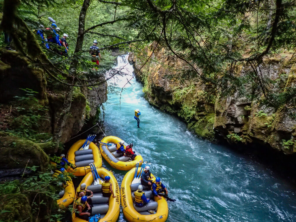
With a fresh four feet of snow piling up high and the rafting season a month away, it’s a great time to take a look at the snowpack and see what it means for the 2024 whitewater season. We live and play in a very dynamic area where weather events can change our outlook quickly. Varying weather patterns over the last two years are great examples of how winter weather effects our spring and summer whitewater recreation.
March of 2022 we had a well below average snowpack and were preparing for a low water whitewater season. However, a month of unusually heavy rain and snow during the spring, turned around the outlook for the season! The Wind and Hood season ended up extending into late May. The Owyhee went from a snowpack in the teens to 300%. The Main Salmon in Idaho had big water, and the White Salmon was high enough that Husum was not low enough to run until late July! March of 2023 was a consistent, above-average snowpack followed by consistent rainfall later in the spring. We had an amazing year, with a long and full seasons on every single river we operate on. Two years of great water levels with remarkably different projections as of March.
Which leads us to 2024. Snowpacks are currently slightly above average for the Columbia Gorge, well above average for the Owyhee watershed, and below average for the Main Salmon in Idaho. The Main Salmon is a massive watershed that has great flows even when the water levels are lower, so there is no danger of a shortened or modified season with lower snowpack. Conversely, the Owyhee is not a river that can sustain a whitewater season after a low snowpack. An above average outlook for the Owyhee in March means we should be able to launch all our trips this year. Above average snowpack in the Columbia Gorge also promises a great season and is typically bolstered by spring rainfall.
Let’s take a closer look at each of these river stretches and how they are impacted by weather, snowpack, and rainfall:
Owyhee River
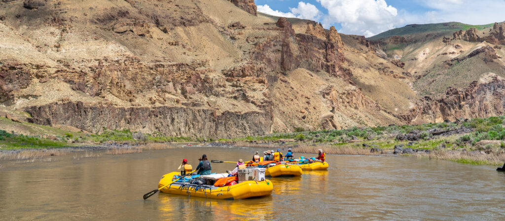
The most tumultuous and unpredictable snowpack in our Wet Planet sphere of river running is the Owyhee. This five-day trip features some of the best scenery and hiking in the Northwest but its water source is dependent on the Northeastern Nevada Mountain Ranges known for feast-or-famine snowfall. So far in 2023/2024 the entire drainage has been a bullseye for storms rolling off the Pacific. If this trend continues, we should be feasting on the Owyhee this spring!
As of March 1st 2024, the Owyhee snowpack is at 157%. With our first Owyhee trip only six weeks away we love seeing numbers that high, but what exactly does it mean? In a literal sense, it means at an elevation of 7,000 ft, the mountains feeding the Owyhee have between 3 to 5 feet of snow. That might not seem like a lot, but for a river that typically has a boat-able spring window only through April and May, that is more than enough for Wet Planet to run great rips on all our scheduled departures.
With over a month still to go, things can still change. Early warm temperatures and rain events can cause early runoff, while continued storms can just as easily bring that number even higher. For some context, March 1 2022 the Owyhee snowpack was in the teens, forcing us to cancel the entire season. Intense snowfall in late March/April brought the snowpack up to 300% in a matter of weeks!
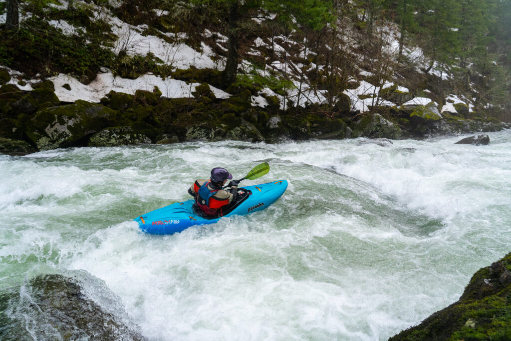
Wind River
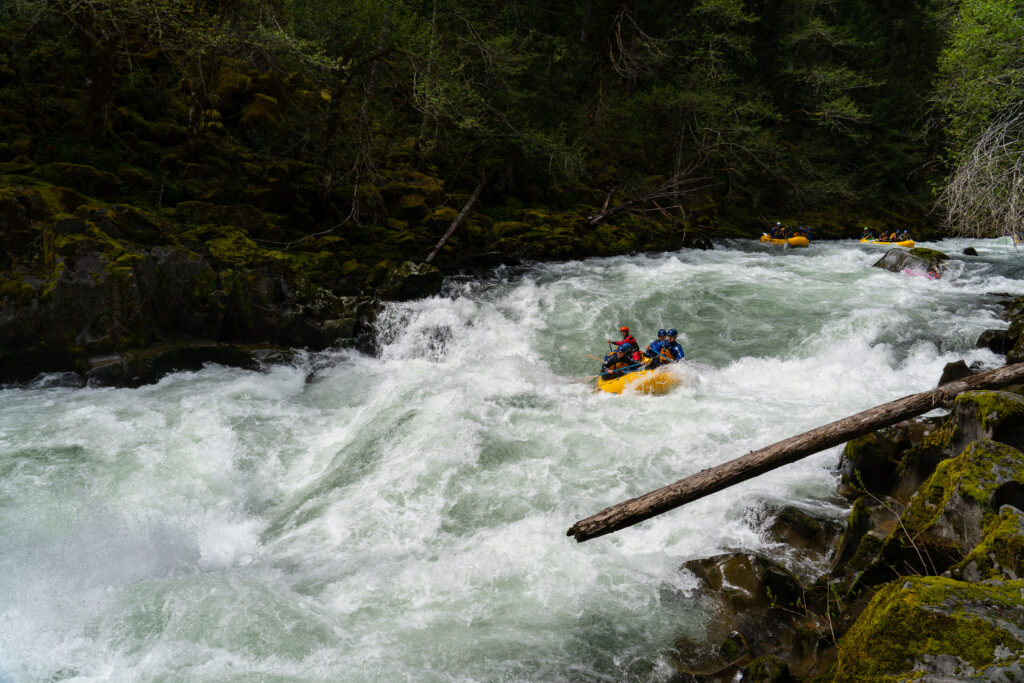
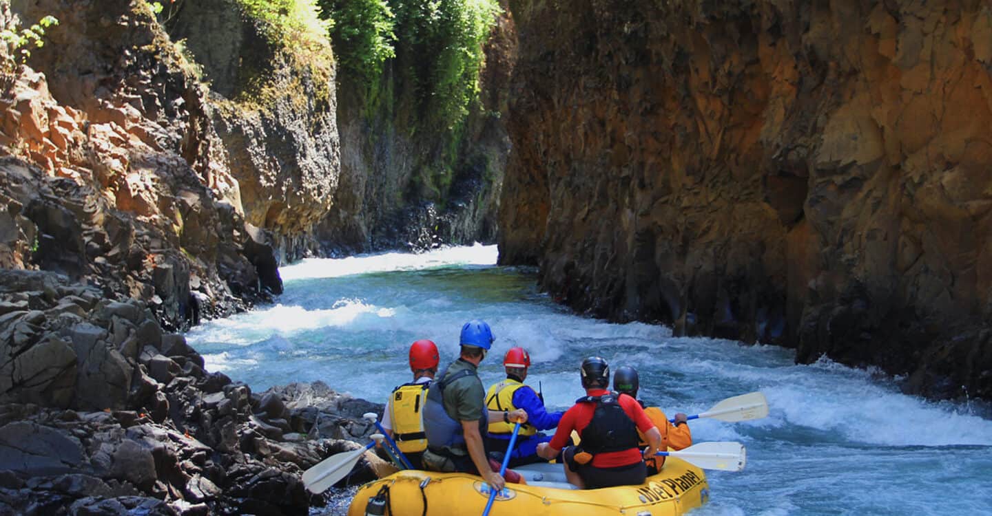
The Wind is one of, if not the best rafting runs in the Columbia Gorge. It is the next level of rafting for those who thrive on the White Salmon and are thirsty for an even greater challenge. The difficulty of this run means only the most experienced guides at Wet Planet embark on this memorable Class IV-V journey.
Nearly every winter and spring storm cycles that hits the Columbia Gorge will bring levels on the Wind to runnable levels. Rainfall in lower elevations will have an immediate impact, while snowfall at higher elevations get deposited and stored for runoff in the spring.
The peak of the Wind River drainage is significantly lower than that of the surrounding rivers like the White Salmon, Hood, and even the Klickitat. While snowpack can play a prominent role in our Wind River rafting season, rainfall is just as important. Based on gauges near the headwaters of the Wind, the current snowpack is about 90%. That number says to us, we will have a 2024 Wind season, but we are uncertain how long it will last. The amount, location, date, and temperature of spring rain will have the biggest impact on how many Wind trips we are able to launch this season. The past two years have been amazing for rafting on the Wind. Our experienced team of guides, most of whom are local and boat on the Wind year round, are stoked and prepared for another great year.
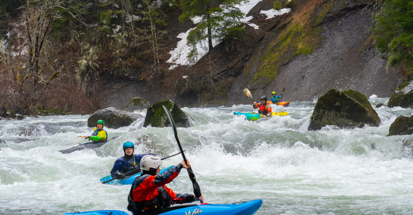
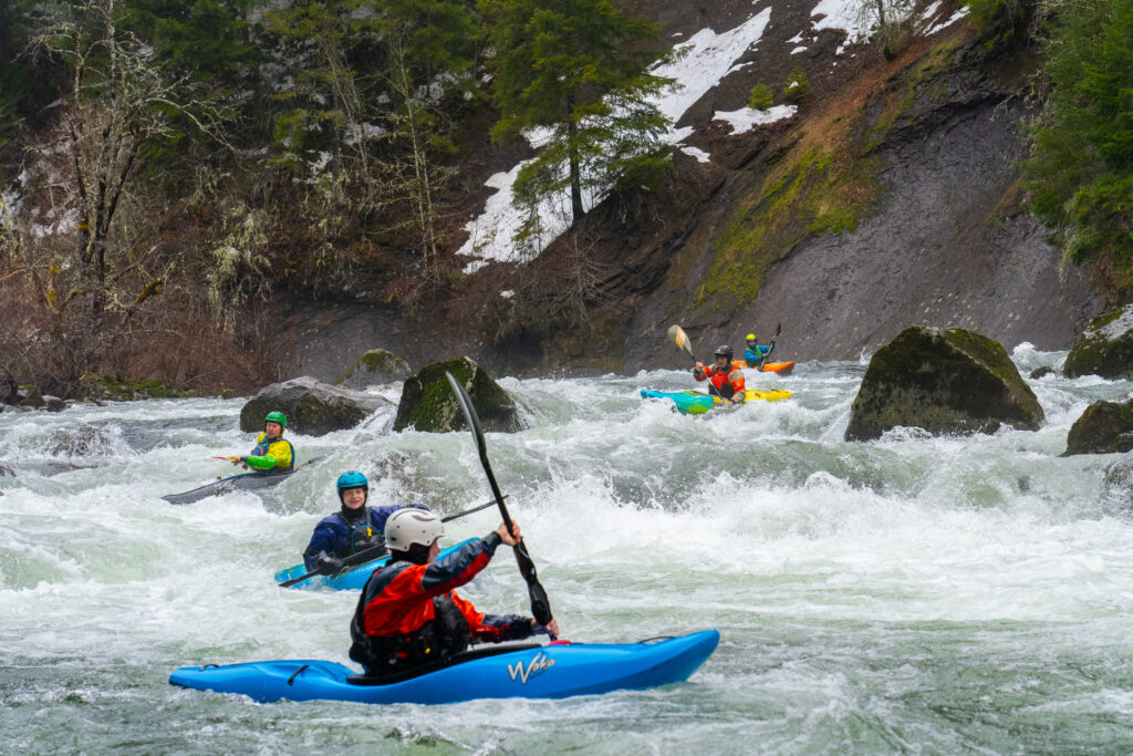
White Salmon River
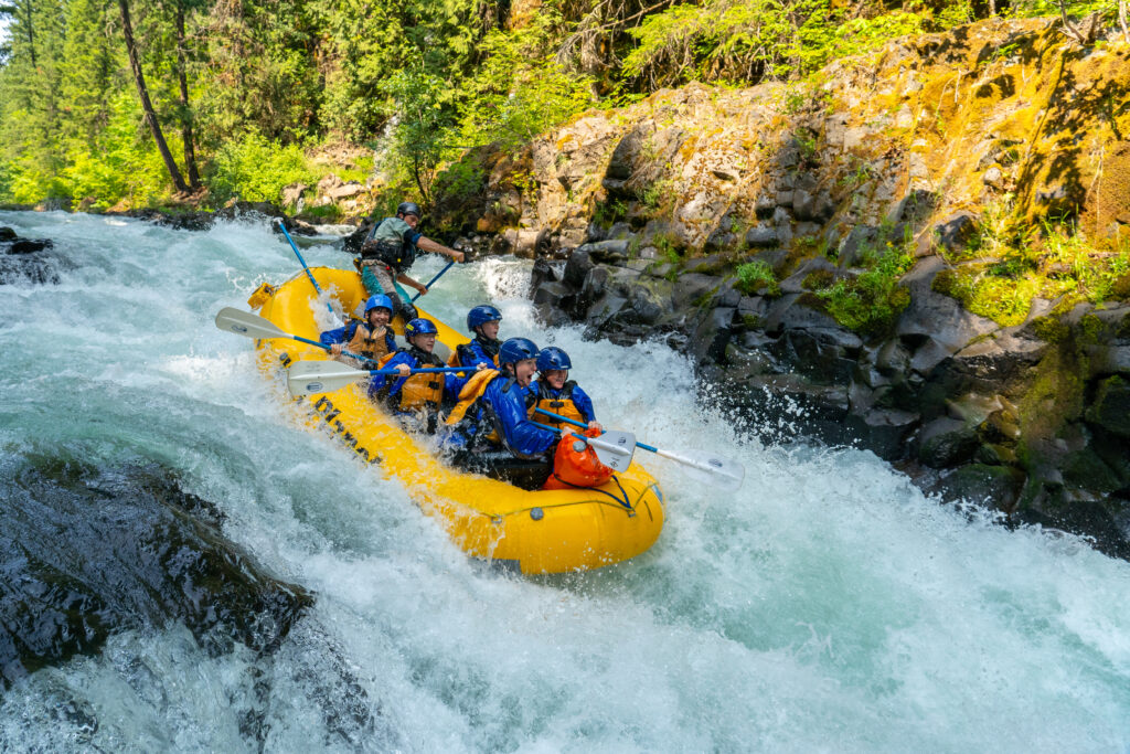
The headwaters of the White Salmon is a glacier on the southern slope of 12,000 ft Mount Adams. That high elevation glacier allows those who raft and kayak on the White Salmon the unique ability to do so all year round. While snowpack is important when it comes to consistent flows through the summer, the presence of a glacier makes this snowpack the least important of all the rivers we run. With that knowledge, the snowpack on Mount Adams currently sits at 120%. The snowpack is around 6 ft deep at 5,000 ft with an estimated 10-12 ft closer to the summit. Our water levels are currently looking good for the 2024 season. While we’ve seen slightly less snow than last year, we have seen significant rain at lower elevations.
In a practical sense, what does this snowpack mean for high-water, Husum Falls, and the Upper section of the White Salmon? While glacial runoff ensures a full season of rafting on the White Salmon, water levels will dictate when we are able to begin rafting Husum falls and the upper section. Anticipating average snowfall in March and average rainfall in April and May, we are likely to see 1-2 weeks of high-water on the White Salmon sometime in April. The river will likely drop to a level where we can begin running trips on the amazing Upper section and Husum Falls starting in early July. There are a lot of factors that can influence this (2022 as an example!), but as it stands this seems like the most likely outcome.
When we think about water levels on the White Salmon, we need to think about four things; snow melt, glacial melt, current rainfall, and springs. Let’s touch base on all of these. Snow melt is typically at its peak in the spring when temperatures increase. It is very common to drive through the Columbia Gorge on a warm spring day and see lots of water flowing off the mountains. The White Salmon is no different and this melting snow will cause levels on the White Salmon to spike, typically sometime between April and early June. When the snow is gone, the White Salmon glacier begins melting at an accelerated rate becoming the primary source of water for the river. Few rivers in the Pacific Northwest are still glacially fed, so consider the White Salmon a bit of an anomaly. Any significant rain event, typically in the winter and spring, will runoff into the White Salmon through tributaries and increase river levels in the short term. The White Salmon typically experiences its highest flows during the winter due to heavy rain. Our volcanic geology puts the White Salmon in a unique position to absorb and maintain all three sources of water; snowmelt, glacial melt, and rainfall for longer than the typical river. Within the porous volcanic basalt, miles of aquifers (underground chambers of water) are filled and then slowly filter into the river through freshwater springs. Instead of all the rain and melt rushing into the river all at once, these aquifers allow some of that water to be held underground and gradually added into the river over time. While other rivers run dry, incredibly, the White Salmon is perfectly situated to maintain boat-able flows every day of the year.
Hood River
Often used as our alternative to the Wind River when levels are too high, or an advanced section for our guide school training, the Hood has the potential for a stellar winter and spring season. In a good year, we may only run a handful of trips on the Hood, but it remains one, of if not the best rafting run in the Columbia Gorge.
The Hood is fed by the Northern and Northeastern slopes of Mount Hood in the form of two major tributaries, the West Fork and East Fork. The current snowpack on Mount Hood is around 90%. From purely a snowpack perspective, that is likely enough for multiple weeks of rafting sometime in April and May. Similar to the Wind, spring rainfall will play a dominant role in timing, water levels, and the length of the season. The Hood River can be a challenging stretch to get on with varying water levels, but it’s always worth the effort for our experienced, adventure seeking guests. If you’d like to be on our call list to be notified when we are running trips on the Hood River, send us an email!
As an interesting side note, the Hood has the same three water sources as the White Salmon (rainfall, snowmelt, glacier melt) but lacks the aquifers to slowly distribute water throughout the summer. Because of that, and the wider river bed, the Hood runs out of water early and the White Salmon does not!
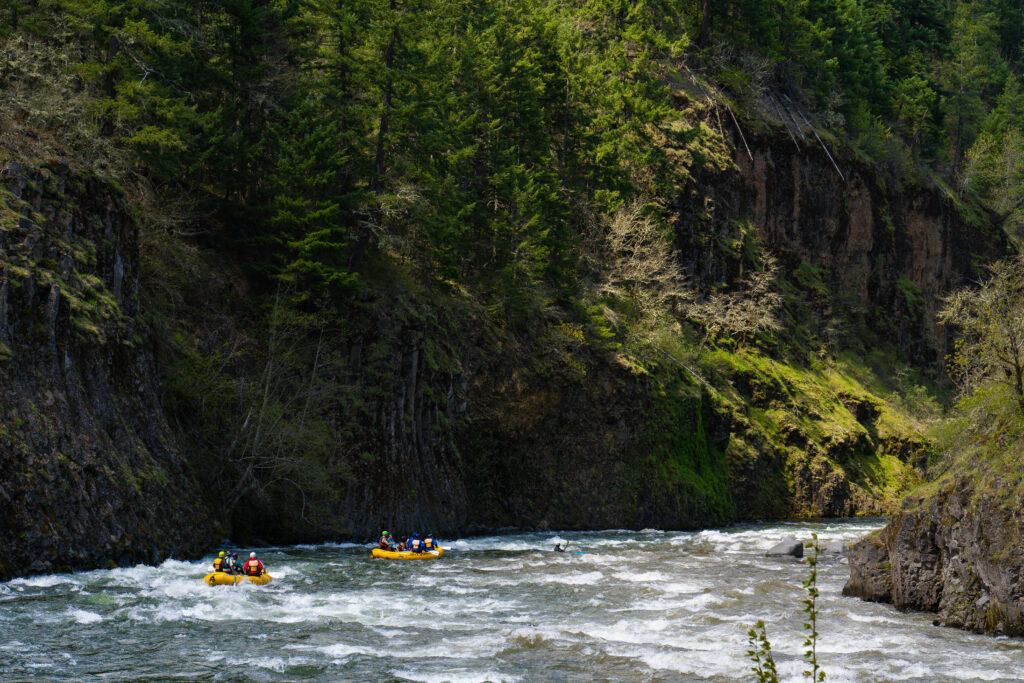
Main Salmon River
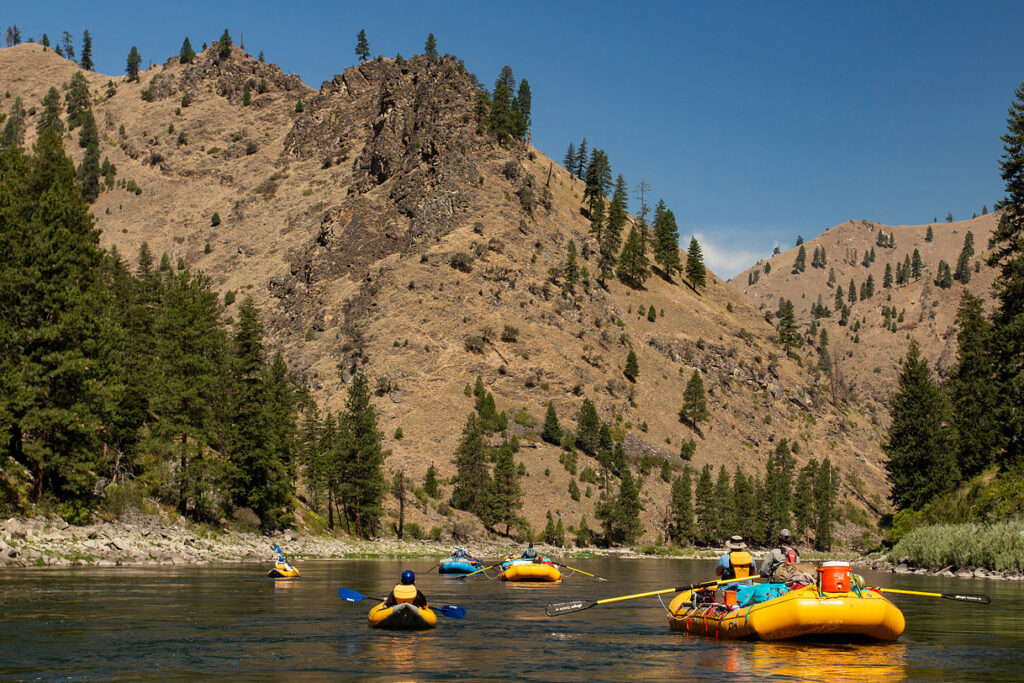
The watershed for the Main Salmon is massive, including large upstream tributaries that are also rafted like the South and Middle Fork of the Salmon. Because this area is so massive, the runnability of the Main Salmon is never really in doubt. For example, low water seasons on the Middle Fork of the Salmon force companies to modify by flying guests into a lower starting point where the river has enough water. The Main Salmon is downstream of the Middle Fork and has more than enough water to avoid any logistical changes. There are pros and cons to both high water and low water seasons, but the scenery, camping, whitewater, and surrounding environment remains spectacular.
Spread across the drainages, the average snowpack for the Main Salmon is about 90%. At 7,000 ft there is around 6 ft of snow with significantly more at higher elevations. While Idaho has not been the target of the biggest winter storms, that can easily change in March and April. We expect to see a brief period of high-water spring runoff sometime in May and June, followed by normal to lower flows for the remainder of the season.
Conclusion
A fundamental goal at Wet Planet is to give our guests access to our favorite stretches of whitewater in Washington, Oregon, and Idaho. Whether it’s in a kayak or a raft, we strongly feel the value of spending time in these places is immense. Each year Wet Planet strives to share the incredible experiences in all of these places. We’re not always able to enjoy the beautiful scenery on all of these rivers, but during the best years we get on all of these favored stretches. Each winter and spring, we eagerly watch and analyze what the snow and rainfall is doing in Oregon, Washington, and Idaho in anticipation of another fantastic year. This year it looks like mother nature has gifted us with a favorable conditions that promises to provide incredible experiences on all of our cherished rivers! We hope you can join us.