
The Unique Geology of the Owyhee Canyonlands
The Owyhee River flows through the rugged wilderness for 120 miles in one of the most remote areas in the United States. When rafting this nationally designated Wild & Scenic river, people are often stunned by the unique geological features of the area. What makes up the iconic chocolate cliffs of Lambert’s Dome, or the red and pink rock of Iron Point Canyon? In this brief overview of the Owyhee River geology, we will explain the notable features you’ll encounter on a multi-day rafting trip.
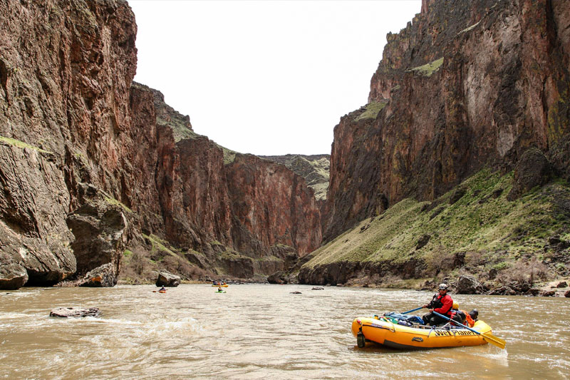
Rafting the Lower Owyhee River
Notable features of the Owyhee River Geology:
- Iron Point Canyon
- Expansive plateaus
- Chalk Basin – Pruitt’s Castle and Lambert’s Dome
- Crumbling basalt landslides
- Hot Springs – Ryegrass & Greely Bar
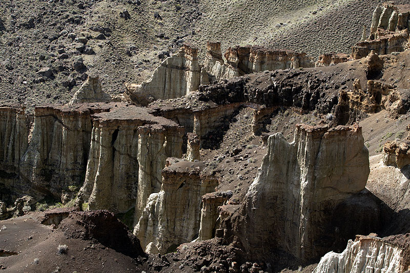
- Hoodoos
- Devil’s Tower
Beginnings of the Owyhee River Geology
The Yellowstone Hotspot
Let’s start from the beginning. Most people have heard of Yellowstone, the national park famous for its gushing geysers and dramatic canyons, which sits atop a geothermal hotspot in Wyoming, Idaho, and Montana. This geothermal hotspot – the Yellowstone Hotspot – is also what created the Owyhee Canyonlands and Jarbidge-Bruneau Wilderness.
Hydrothermal action in present-day Yellowstone National Park
As the North American tectonic plate moved southwest, the hotspot was active under different parts of the land. Even though it looks like the hotspot is moving, it’s important to remember that the slab of land that makes up North America is actually what’s traveling over the plate, and has been for millions of years. The hotspot itself is stationary. About 17-15 million years ago, the eruptive center of the hotspot was active under what is now the Owyhee River Canyonlands. This is referred to as the Owyhee-Humboldt eruptive center, and is the reason for the explosive eruptions that created the present-day Owyhee Canyonlands (Camp & Wells, 2021).
The Yellowstone Hot Spot Track (NPS.gov)
Eruptions of Rhyolite and Basalt – 17-15Ma
“The Owyhee area preserves ancient, highly explosive caldera eruptions that have been eroded over time.” –Of Lava, Yellowstone, and the Owyhee
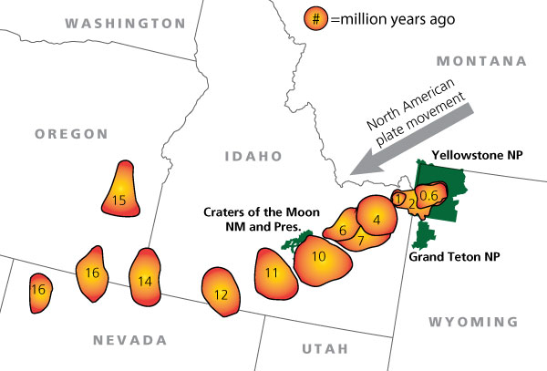
The most common types of rock in the Owyhee River geology are rhyolite and basalt. Rhyolitic eruptions dominated the area from 17-15 Ma. Rhyolite eruptions are very viscous, which means they have a thick, sticky consistency. They can be hundreds of feet thick and take years to cool.
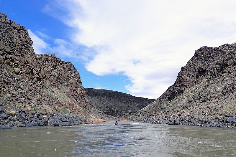
A kayaker staring up at the think, steep, rhyolite canyon wall
As rhyolite cools, vertical fractures form, which creates pillar-like formations. Much of the rhyolite is still underground, but we are able to see it exposed in the steep, vertical canyons where the river eroded through the rock (Owyhee Volcano Geoscience). After all, there’s a reason why the Owyhee River is nicknamed Oregon’s Grand Canyon!
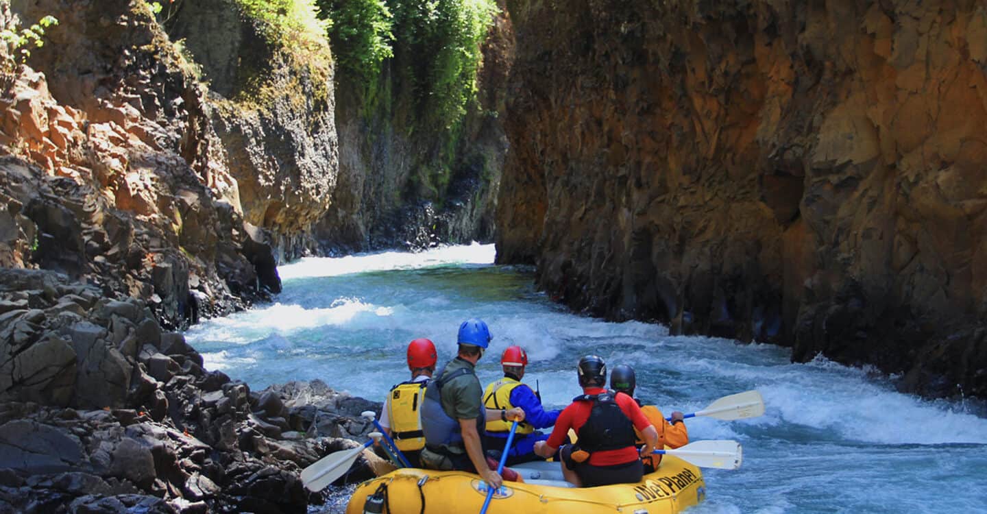
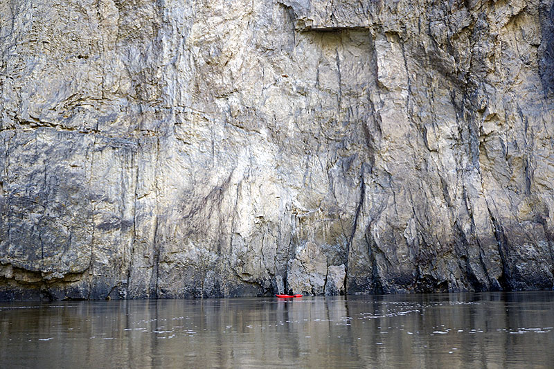
Multi-day guide Giani rafting through Iron Point Canyon
Flood Basalts Create the Oregon Plateau – 16.7-5.5Ma
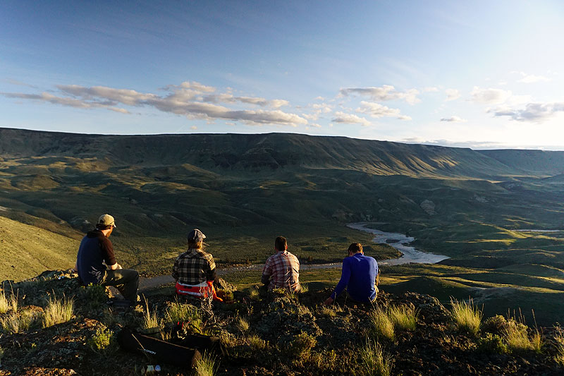
From approximately 16.7 Ma to 5.5 Ma, flood basalts engulfed present-day eastern Oregon, Washington, western Idaho, and part of northern Nevada (read: Owyhee region) (USGS). Over 350 lava flows covered an area larger than 210,000 km^2, which is called the Columbia River Basalt Group. The Oregon Plateau is part of this group. The flood basalts that created the Oregon Plateau are what we see today as we look across the landscape of the Owyhee River.
Faulting, Lakes, and more Basalt Eruptions – 15-2Ma
From 15-2 Ma, faulting occurred across the Oregon Plateau. During faulting, the land is spreading and dropping down. Ancient lakes were formed during this time, and the area probably had a high groundwater level. Over time, the sand on the ancient lake beds were covered with basalt lava, then again by sediment, and again by basalt, and so on and so forth. This creates the contrasting layers that we see in Chalk Basin.
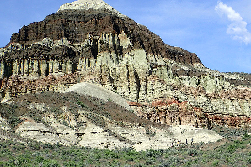
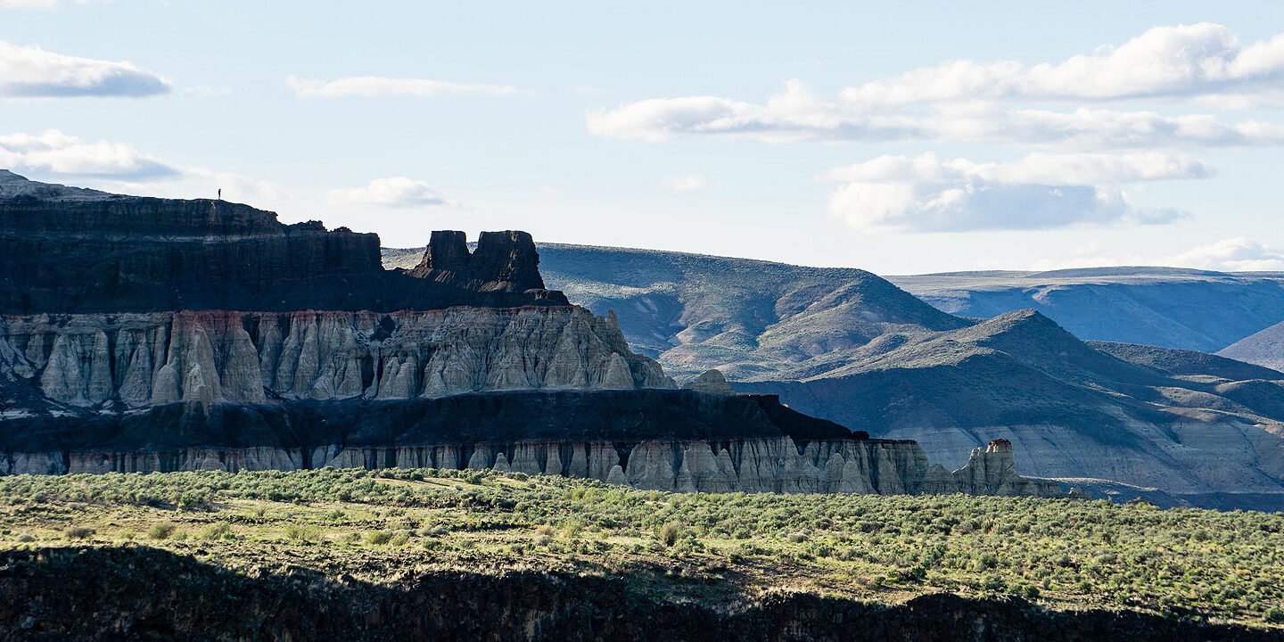
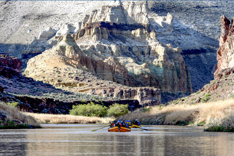
Lambert’s Dome in the Chalk Basin area is the perfect side hike to witness the wonders of the Owyhee River Geology firsthand
“Chalk Basin is composed of pale, ashy sediments from a shallow ancient lake that existed about 10 million years ago. Dark or chocolate horizontal bands are lava flows that poured over the lake beds, baking the clay mud into red brick layers that are resistant to erosion” (BLM).
Recent Owyhee River Geology – 2Ma to Present
Lava Dams and the Meandering River
Fast forward from 2 Ma to present day. Lava never stops! Basaltic lava flows have continued in the last 2 million years.
Young basalt from the last 2 million years crumbles down the banks
These flows created lava dams, which blocked the river, forcing it to find a new route around the young basalt. There is evidence of six basaltic lava flows that caused dams in the last 2 million years – Bogus Rim, Deer Park, Clarks Butte, Saddle Butte, and West Crater. Through a cycle of damming and landslides, the river has changed course numerous times (Ely et. al.).
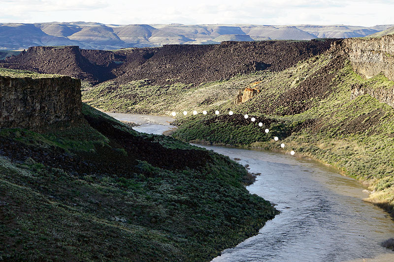
Here, you can see the path the river probably took before this small landslide, which caused it to divert to the left.
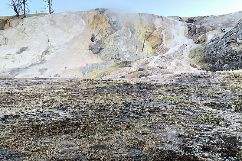
We know there is still geothermal activity in the Owyhee area today from the presence of hot springs. Hot springs are a hydrothermal feature that occur when groundwater comes into contact with hot rocks that are heated by magma within the earth. Some hot springs are too hot for humans, but others are mild enough that we can take a relaxing soak along the river.
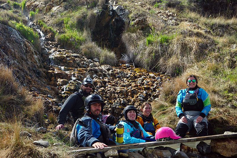
Soaking in Ryegrass Hot Springs on a Wet Planet Staff Trip. From left to right – Jeremy (front), Britt (back), Haley, Nicole, and Sharon
Erosion Uncovers the Past
Two notable features exist in their present state due to the processes of weathering and erosion in the river canyon. Hoodoo formations and Devil’s Tower are both features uncovered and sculpted by these processes. Weathering is the process by which rock is broken down over time. Erosion occurs when the broken down rock is carried away.
Hoodoos
Hoodoos can be found all over the Chalk Basin area. The term Hoodoo describes a column or pinnacle of weathered rock. Thinking back to the previous section, we learned that Chalk Basin is comprised of rhyolite, topped by ancient lake sediment, topped by basalt, topped by more lake sediment, and so on and so forth. The rhyolite and basalt are much stronger than the lake sediment, so they hold sections of rock in place as processes of weathering and erosion slowly wear down around them.
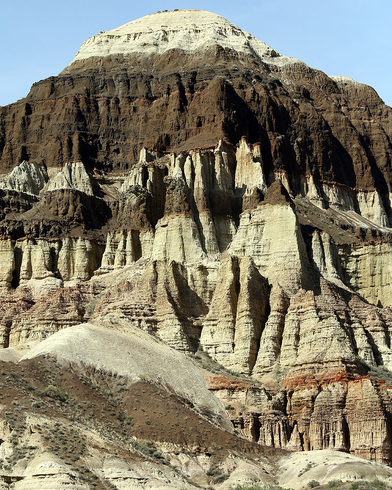
Here, you can see the reddish layers of rhyolite lower down, and the dark layers of basalt higher up, holding the weaker lake sediment in place.
Hoodoos are sculpted through a series of four steps. They start off as plateaus. Through rain, snow, freezing, and thawing, the edges of the plateau begin to wear, making a fin. These same processes erode the weakest layers of the sedimentary rock, creating windows. Then, “hoodoos form where a small cap of the resistant layer remains, and protects a cone of the underlying softer layer from erosion. The heavy cap pressing downward gives the pedestal of the hoodoo its strength to resist erosion” (Hoodoo Geology).
Hoodoo Breakdown Sequence (Brian Roanhorse/NPS)
Devil’s Tower
Devil’s Tower of the Owyhee River is a mass of protruding rock standing tall over the surrounding rock. Similar features to Owyhee’s Devil’s Tower, such as Wyoming’s Devil’s Tower, have been formed through “igneous intrusion,” which occurs when a large mass of rock solidifies within the Earth, and is surrounded by less durable, typically sedimentary rock. The rock itself is possibly gabbro, the intrusive equivalent of basalt, or granite, the intrusive version of rhyolite. (Intrusive rock is magma that has solidified beneath the surface of the Earth, whereas extrusive rock solidifies above the surface). This feature seems to be a batholith, also known as pluton, which is a feature that has “been exposed on the surface through uplift and erosion” (NPS.gov).
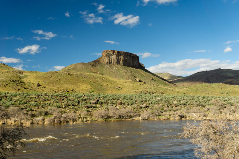
Devil’s Tower on the Owyhee River
Experience the Owyhee River Geology
When you dodge the massive chunks of basalt in Montgomery Rapid, hike through the hoodoos of Lambert’s Dome, and wind through the steep walls of Iron Point Canyon, you can think back to the massive volcanic eruptions that occurred millions of years ago, and understand the processes that expose these features as they appear today. To check out the incredible Owyhee River geology firsthand, join Wet Planet on a 5-day Owyhee River Rafting trip through the 50 mile river corridor this spring!
Okay, that was a lot of viscous volcanic lingo. Here’s the short version of the Owyhee River Geology:
Owyhee River Geology:
- 17-15 Ma – The Yellowstone Hotspot caused giant, explosive rhyolitic eruptions, which created the steep, red-walled canyons we see today.
- 16.7-5.5 Ma – Present day Oregon, Washington, western Idaho, and northern Nevada were covered in flood basalts, which created the Columbia River Basalt Group. Part of the CRBG is the Oregon Plateau, which the Owyhee River cuts through.
- 15-2 Ma – A process called faulting caused the land to spread and drop down, which was filled in by ancient lakes. Over time, the lake beds were covered with basalt lava, then layered again with sediment, and again with basalt, causing the contrasting layers seen in Chalk Basin and other spots along the river.
- 2 Ma to present – Basaltic lava Basaltic lava flows occurred in the last 2 Ma. These flows created lava dams and landslides, which blocked the river and caused it to change course numerous times. Big, crumbling chunks of basalt from these flows can be seen in many places along the river.
- Present-day – We know there is still geothermal activity in the Owyhee region due to the presence of hydrothermal hot springs.
Head to this blog to learn more about The Owyhee River.
Author Sharon Saltoon is a kayak instructor and Communications Manager at Wet Planet. She loves being a part of the team at Wet Planet and sharing her love of whitewater on and off the river!