By Susan Hollingsworth
The restoration of the White Salmon River has already been an intriguing process. In just a few short months the river bed has transformed, revealing debris and structures buried for the last hundred years. Thanks to local Heather Herbeck with Sheer Madness Productions, we can see some great comparison photos.
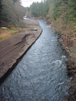
Looking upstream from the Northwestern lake bridge at Buck Creek, flowing into the White Salmon River on the left side of the photo. This photo was taken approximately 3 weeks after the draining of Northwestern Lake and the breach of Condit Dam.
Notice the dock on the downstream side of the confluence, sitting at least 10 feet from the shoreline.
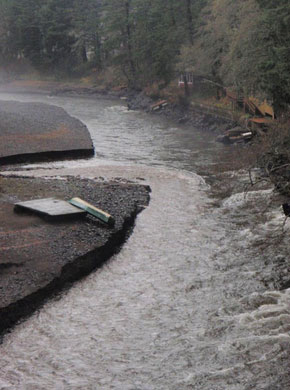
The river flows with the brown hue of a rainstorm. This river might be more brown than most as it continues to rip sediment from the canyon walls. Heather shot this photo on November 22, 2011. Again, take a look at that dock.
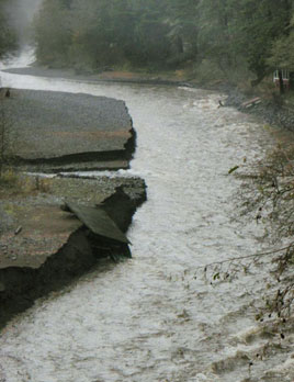
The White Salmon River saw it’s first rainstorm on the night of November 22, 2001 after the breach of Condit Dam. With each rainstorm more sediment will be pulled fromt the shoreline and the riverbed will continuously get deeper.
Notice the dock hanging here. Just a day before it sat high and dry on a large sediment deposit, indicating the amount of mud that will be steadily stripped away as the area sees more precipitation.
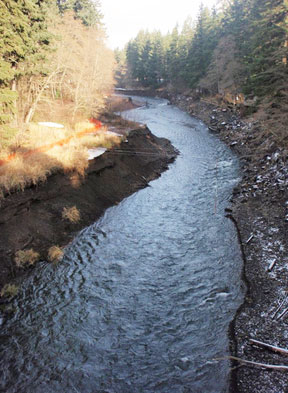
Another look upstream toward Buck Creek and no sign of dock. The confluence looks even more eroded. Taken December 16, 2011.
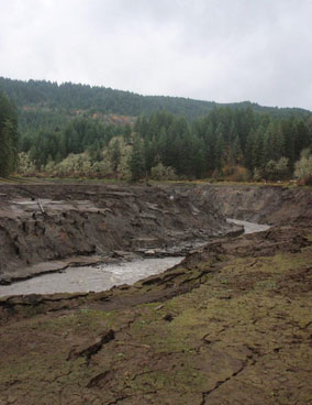
Photo taken by Heather from just a few miles upstream of the dam, looking at river left.
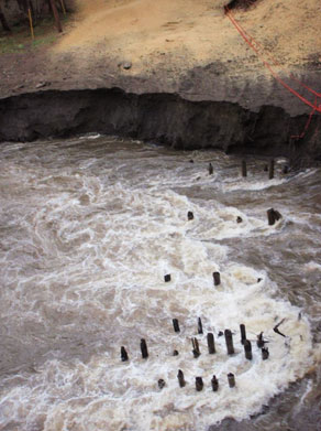
The White Salmon continues to unearth lost treasures. Or at least some interesting historical structures.
These remnants of an old bridge began to appear after the rainstorm on November 22, 2011. They are just under the current bridge on Northwestern Lake Rd. The day before, they had been covered in sediment.
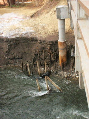
This photo of the bridge pillars was taken just a few week slater, on December 16, 2011. Photographer notes that some of the pillars have been pulled out, but more structures from the previous bridge have also appeared within the sediment.
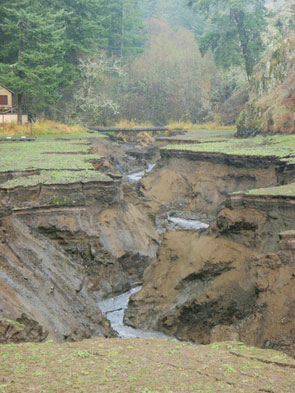
A side creek had quietly been flowing into the mud-pit of Northwestern Lake for 100 years. Now, as the sediment in the bigger lake begisn to disappear, we can see that the mud filled in smaller tributaries as well. This creek is sure to see some drastic changes throughout the winter. Photo taken in December.
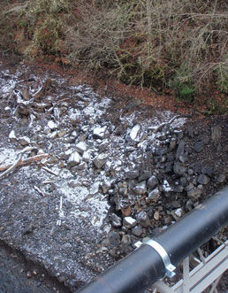
Looking at the river left side of the White Salmon River just upstream of the Northwestern Lake Bridge. We are already beginning to see a hint of a true riverbed as bedrock slowly becomes exposed after rainstorms.


