
Wahkeena Falls Trail. Photo: Debbie Asakawa
Eagle Creek Trail System Update
Crews from the United States Forest Service, Oregon State Parks, Friends of the Columbia Gorge, Trailkeepers of Oregon, Pacific Crest Trail Association, the Washington Trail Association and more have been working hard since the 48,000-acre Eagle Creek Fire was fully contained on November 30, 2017. Several of the most sought-after trails have been re-opened, some have opened and closed a few times, which is expected after so much vegetation has been lost, and some still remain closed.
What Eagle Creek Hiking Trails Are Open?
First a disclaimer: Keep in mind that the Forest Service has reopened trails but warns hikers to enter at their own risk because of hazardous conditions including loose rocks, falling trees and limbs, debris flows, and damaged or blocked trails. Less experienced hikers should consider alternatives to hikes in this are while these conditions exist, and all hikers with dogs or small children should consider safer alternatives. Just this week, the Wahkeena-Multnomah loop was closed until further notice due to rockfalls caused by the recent rains.
Please keep in mind that trails can open and close at any time so the information published here may not be correct when you read it.
Click here to see what’s open…
Angel’s Rest: Open
Angel’s to Devil’s Rest Loop: Open
Multnomah – Wahkeena Falls Loop: Was Opened but currently closed. Trail Alert, Apr 5, 2019: Active rockfall is happening between Benson Bridge and the first switchback at Multnomah Falls. Trail is closed until further notice.
Multnomah Falls: The hike up to Benson Bridge will remains open.
Multnomah Falls to Devil’s Rest: Trail Alert, Apr 5, 2019: Active rockfall is happening between Benson Bridge and the first switchback at Multnomah Falls. Trail is closed until further notice.
Multnomah Falls to Larch Mountain via Oneonta Trail: Trail Alert, Apr 5, 2019: Active rockfall is happening between Benson Bridge and the first switchback at Multnomah Falls. Trail is closed until further notice.
North Lake: Open
Wahkeena Falls: Officially Open (We have not been on the trail, however, there have been reports of slides possibly affecting the conditions of the Wahkeena trail.
Horsetail, Ponytail & Triple Falls: Open — Trail is open only to Ponytail Falls. Past the falls, the trail is closed because of damage from the 2017 Eagle Creek fire.
Larch Mountain Crater Loop: Trail Alert, Apr 5, 2019: Active rockfall is happening between Benson Bridge and the first switchback at Multnomah Falls. Trail is closed until further notice.
Toothrock: Partially open: Parking here and the paved Historic Columbia River Highway State Trail is open. Gorge trail #400 is closed.
Starvation Trailhead to Warren Creek is open allowing access to the Mount Defiance trail. Starvation Ridge Cut-off trail (#414B) is closed due to a washout on the trail.
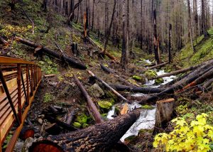
According to one Friends of the Gorge Trailhead Ambassador’s notes, “Perhaps the best (and safest) trail that is now open is the Herman Creek Trail to Casey Camp. See the details above. The area along Herman Creek suffered a “moderate burn” in most places. It is a good trail to get a visual impression of the effects of the fire, the work required to clear trails in the burn area, and early recovery of the forest.
For a more comprehensive look at what is open or closed due to the fire you can cross-reference lists from the Forest Service or this map (not as up-to-date) from the Forest Service and Friends of the Gorge
2019 Dog Mountain Hike Update:
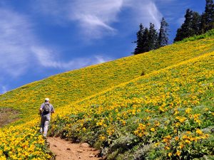
Photo: Greg Lief
The wildflowers are close but not quite there. Once the wildflower bloom is in full effect, we know a lot of people will be interested in hiking Dog Mountain. Here’s the scoop on permits and payment: $1 permits are required Saturdays & Sundays from April 20 through June 16 for everyone using the Dog Mountain Trail System. The system includes Dog Mountain Trail (#147 and #147C), Dog Augspurger Tie Trail #147A, and the lower portion of Augspurger Trail #4407. Hikers on the system will be required to carry a hard copy permit or electronic proof of purchase.
Permits:
Pre-purchased permits are required and cost $1 per person. There will be 250 permits available per day through the national online reservation system. Permits will be available without reservation for all visitors who use the Dog Mountain shuttle service ($2 roundtrip) from the Skamania County Fairgrounds, operated by Skamania County (more shuttle service info. here).
Parking and Parking Fee:
A daily, per-vehicle fee of $5 is charged for use of the Dog Mountain Trailhead facilities. Visitors can pay the daily fee on-site or online here. Annual passes such as the Northwest Forest Pass ($30) and other inter-agency senior, military, and Every Kid in a Park passes are accepted as alternate forms of payment – Dog Mountain is on federal land, so the Discovery Pass is not valid. Note that this fee is in addition to the reservation fee charged to reserve a Dog Mountain Trail System permit.
Our Recommendations for Great Hikes and Waterfalls
Although Dog Mountain is a great hike, there is so much more to explore in the Gorge. Same goes for the Eagle Creek area, which is absolutely amazing and near and dear to our hearts. We love to recommend getting farther east in the Gorge to beat the busy trails and crowds. If you’re traveling from Portland it doesn’t hurt to stop at Multnomah Falls, or even to get off I-84 for a bit and check out “waterfall alley” on the Historic Columbia River Highway, but there are plenty of other hikes, wildflowers and waterfalls beyond.
Pick up a copy of Curious Gorge at Wet Planet or from many other stores in the area and take a look at Panther Creek Falls or Falls Creek Falls.
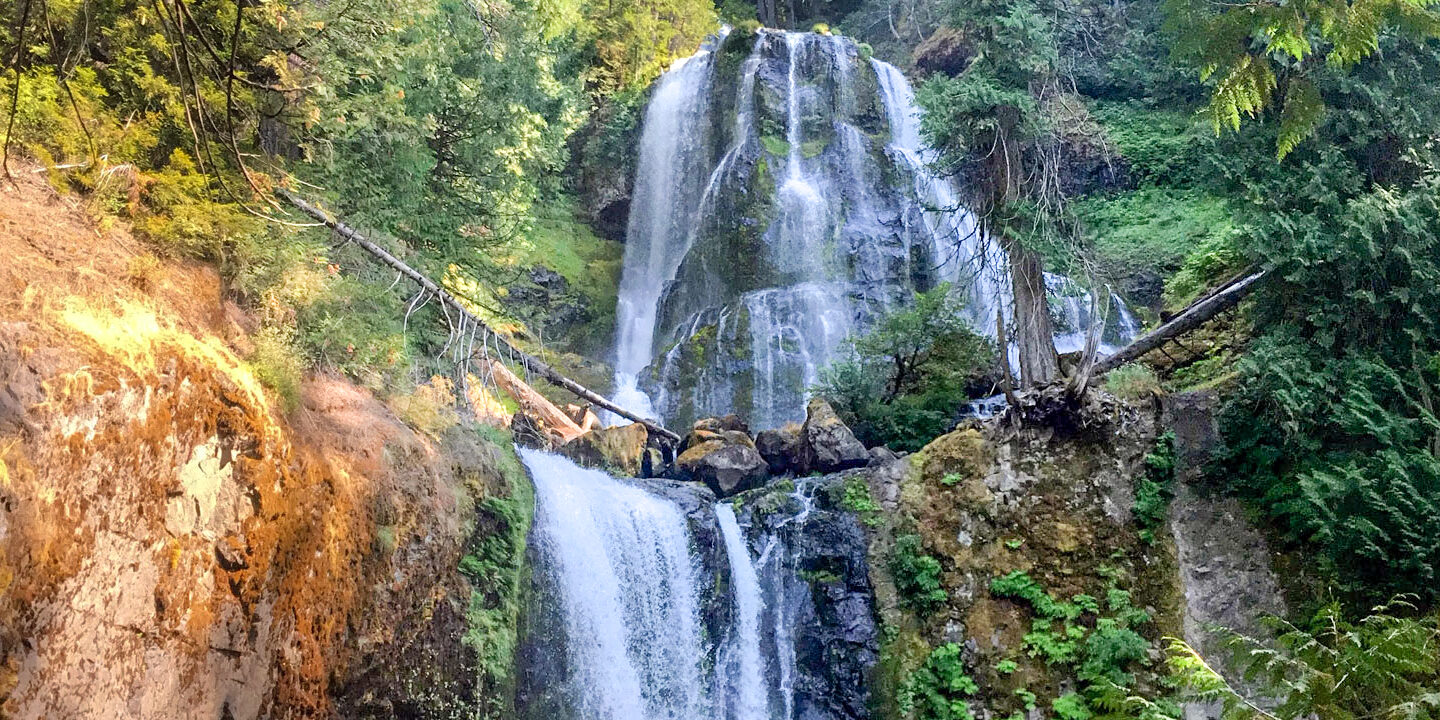
For a great hike and waterfall viewing: Falls Creek Falls
Check out Falls Creek Falls. Falls Creek Falls includes a beautiful 3.4-mile up-and-back hike along a creek through old growth trees of the Gifford Pinchot National Forest. At the end of the 1.7-mile trail you encounter the 335 foot three-tiered falls with the tallest tier being 135 feet. The falls are truly amazing. There’s a scramble up a steep and difficult scramble up to the top of the falls, but most people do not do this stretch. Some people swim in the pool below, but it’s brisk. Here is the Falls Creek Falls location, directions and information from Gorge Friends.
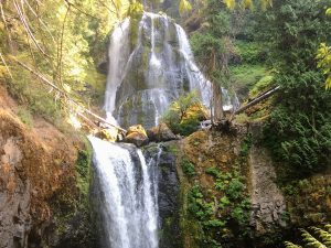
A unique waterfall with no hiking necessary: Panther Creek Falls
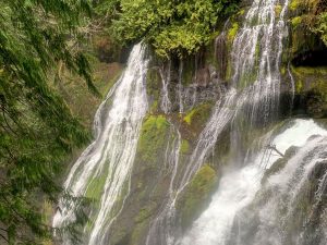
For a great waterfall without the hike: Check out Panther Creek Falls. Panther Creek Falls has an easy one or two-minute walk to a viewing platform. The falls is a horsetail style of water fall cascading 130 feet over two tiers, the tallest being 102 feet. The make-up of the falls is beautiful and unique, with water gushing right out of the moss-covered rocks it cascades down. Here is the lowdown on Panther Creek Falls (location, directions, and information) from Gorge Friends.
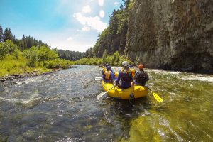
Rattlesnake Falls: Can be paired with a spring White Salmon rafting trip
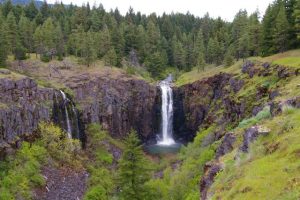
Photo from oregonhikers.org
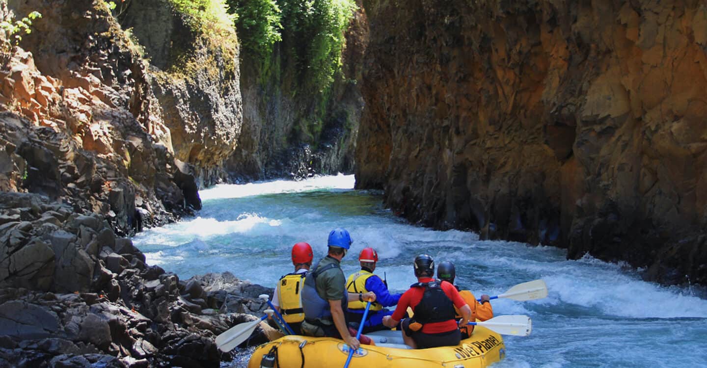
Want to pair a waterfall hike with your Wet Planet White Salmon River rafting trip?
Look no further than Rattlesnake Falls. The hike is not very difficult and is about .5 miles in from the parking area before you approach the approximately 100-foot falls. The falls usually runs dry by June, but it’s great for a spring visit. If you want to make the trip a real adventure, you can hike .25 miles heading downstream around the rim, below and to the right is another approximately 100-foot waterfall! Here, at the top of the lower falls, you can hang out in the sun. Here is the location and directions from OregonHikers.org.
Labyrinth Loop Hike
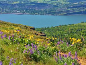
Photo: Annette Hadaway
For a long, sunny hike with amazing views, wildflowers and waterfalls in springtime, look to the approximately 7.5-mile Labyrinth loop hike. The hike has views up and down the Columbia River, as well as Mt. Hood across the river. Here is the information link from OregHikers.org.
Author Mikey Goyette leads Wet Planet’s Marketing team. When he’s not in the office, you can find him in his kayak on the river, or on the river bank playing Spike Ball.
Mikey relaxing on a day hike in the Grand Canyon.